Monday’s rains were just the beginning. More rain and thunderstorms are to follow on Wednesday.
Monday’s heavy rains have already caused flooding in some places, but the week will bring more rain as it progresses.
On Wednesday, heavy rains will return to the south and center of the country. Thunderstorms are in the forecast too.
The weather will continue to be variable and unstable this week. By Wednesday and the night before Thursday, heavy showers and thunderstorms are expected to develop in the south and central parts of the country.
“The thundershowers may be accompanied by heavy rain, hail and strong gusts,” said meteorologist Sara Salonen at weather service Foreca.
Wednesday morning will start mostly clear, but as the day progresses, clouds will increase in the south and central parts of the country. More rain is on the way.
“New showers will spread from the south to the south and central parts of the country during the day on Wednesday, with thunderstorms possible on the very south coast during the day,” said Salonen.
In addition, according to Salonen, the easterly winds will start to pick up.
“Severe thunderstorms are developing in the Baltic. It is likely that thunderstorms will spread to Finland in places during Wednesday evening and into the night, especially to the south and east of the country.”
It is likely that the showers and thunderstorms will be accompanied by heavy rain, hail and strong gusts. Rainfall accumulations will be between 5 and 15 millimeters over a wide area and locally more in the case of thunderstorms,
As for the mid-week rains, the Flood Centre notes that the soil is wet and the waterways are full of water, so watercourses will react much faster to the rains than before.
Heavy rains, warm temperatures
Daytime temperatures on Wednesday will range from 16 to 21 degrees Celsius, with lows in rainy areas and northern Lapland. Toward Thursday night, temperatures in the south and central parts of the country will range from 15 degrees on either side to 15 degrees, with 5–10 degrees in the north.
On Thursday, rain will move from south to north—in the east, temperatures could reach up to 25 degrees Celsius in places.
On Thursday, rain will fall in many places. A low pressure with rain will move from south to north.
“Especially in the eastern part of the country, thunderstorms may develop. Light to moderate winds may be gusty in places, especially in the east. Temperatures in the east of the country may even reach near 25 degrees Celsius during the day if the cloud cover breaks enough,” Salonen said.
Elsewhere in the south-central part of the country, daytime temperatures on Thursday will be mostly 15–20 degrees Celsius, with 11–16 degrees Celsius in the north.
Overnight on Friday, temperatures will drop to between 10 and 14 degrees Celsius in most of the country.
Almost 200 millimeters of rain in Hango in August—more than double the normal August rainfall
August rainfall has been very high in some places.
By 9:00. on Tuesday morning, the total rainfall for August had already reached 196.2 millimeters at the Tvärminnen observation station in Hanko, compared to an average of 78 millimeters for August at this station.
In Vantaa, 157.9 millimeters fell in August at Helsinki-Vantaa airport, 156.3 millimeters at Lohja’s Porla station and 152.4 millimeters at Mustasaari’s Riimala station.
According to weather statistics, the average rainfall in Finland in August is between 50 and 90 millimeters. The record for August rainfall in Finland is 279.3 millimeters, recorded in Alahärmä in 1967.

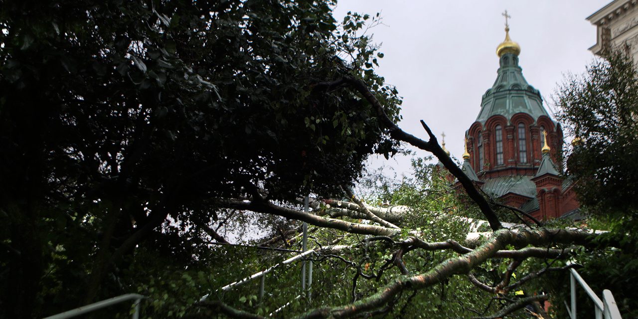
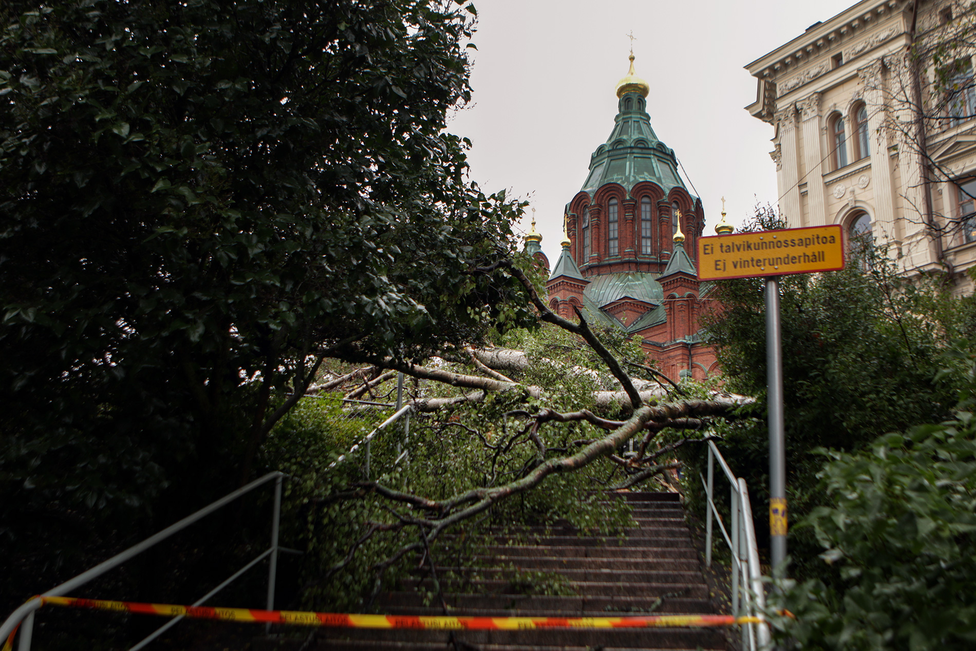
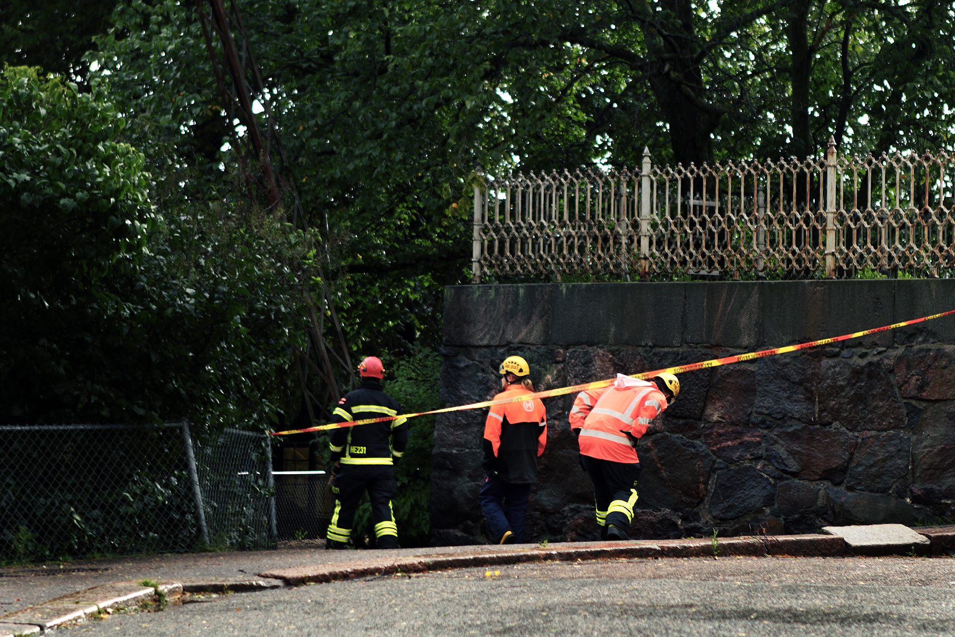
Monday’s rainstorm caused widespread damage
On Monday, the rescue services had dozens of damage control missions on their books. The storm knocked out electricity, especially in the eastern and central parts of the country.
In Finland, around 5,500 customers were without electricity before 9:00 on Tuesday morning following yesterday’s storm, according to the power outage map of the Finnish Energy. The storm disrupted the electricity supply, especially in Häme, South Karelia and Savo.
By Monday evening, the rescue services had been involved in dozens of damage control operations.
Heavy rainfall on Monday caused, among other things, urban flooding in some places and water flooding into buildings.
At the Härmälä observation station in Tampere, up to 66 millimeters of water had fallen by 9:00 in the morning on Tuesday, 59.9 millimeters in Kokemäki and 59.6 millimeters in Juupajoki.
“Finland had a warm air mass, humidity and low pressure that was only just developing near Finland, but did not have time to fade by the time it reached Finland, as is often the case,” said Foreca meteorologist Anna Latvala.
The heavy rainfall caused rivers and streams to flood in many places in southern and western Finland, according to the Flood Centre. In addition to flooding from rainwater, rivers have risen in many places on low-lying fields in Uusimaa and Southwest Finland.
The wind blew down trees on roads, buildings and power lines. In addition, boat moorings were torn away from the shore in the Kymenlaakso region, for example. Most of the damage was in the Kotka area of southern Kymenlaakso on the coast.
The Helsinki Rescue Service reported that the storm had fallen trees on roads and caused other damage across the city. The rescue service noted that it had raised its alert level and had alerted contracted fire brigades to standby.
Over 60 millimeters of rain fell in Tampere
According to the Finnish Meteorological Institute, most rain fell on Monday in the country’s southern, south-western and western parts. In Tampere, for example, the 12-hour rainfall in Pirkanmaa was 65.3 millimeters at half past ten in the evening.
Monday’s strongest gusts were recorded in Häme and eastern Finland on the south coast; gusts of more than 20 meters per second were commonly recorded.